Acces track to Refugio «Hielo Azul»
|
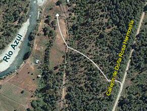
how to arrive ACCESS TRACK TO REFUGIO «HIELO AZUL» The historic public access to the Hielo Azul Hill Refugio starts in the Hue Nain Camping located on the Azul River east bank which can be approached through the Azul River coast path. This access used until February 2006 was arbitrary shut down for public use by the settler Criado. As an answer the Town Council Secretary opened a new access which adds a one more hour walk in order to reach the suspension bridge through which we cross over the Azul River, where the Refugio track starts. From the «Callejon» of Doña Rosa Hermosilla The new provisory access begins in a neighbours passage located on the Azul River Coast Road, going through the Dulcería Rio Azul, on the left hand. Access shown by a Town Council sign: ¨Acceso Refugio Hielo Azul¨.
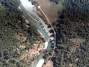
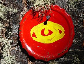
After a five minutes walk you can see the Azul River and two footbridge, one made of cement and an older one, don´t cross them over. Instead continue through the river border, upstream for about forty-five minutes. Follow the red-yellow marks painted on round small sheets.
Reaching the suspension footbridge, it is easily identify as it is the only one nearby and has a sign with recommendations for Hielo Azul travellers.
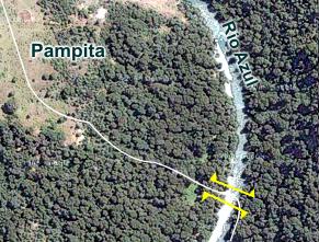
Once you cross over the footbridge (suspension bridge) the path is on your left and goes straight upward. It is clearly indicated in such a way that you should find red-yellow marks as well as white-red ones. Cows make secondary tracks all over the forest, reason why you should walk paying attention to the marks on the trees.
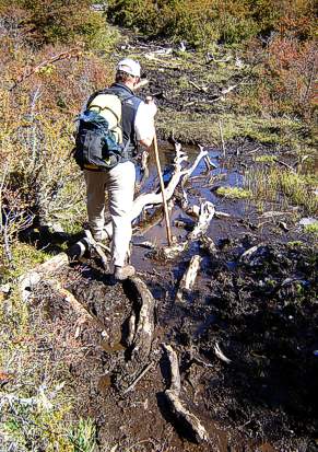
The first strong climb lasts about fifteen-twenty minutes till you reach a green prairie with few trees and a wooden fence that has to be open. On your left you will see a round farmyard. Please close the wooden door. In the prairie the marks are painted on posts stacked to the ground. The track will take you quickly to the right until a stream cross over and back again to the forest. The climb is steep for about an hour and a half, going through different kinds of forest and crossing over only one more stream. Nearby the ¨Mirador del Mallín Ahogado¨ (Mallín Ahogado Viewpoint) The climb is gentle for about 30 minutes till you reach the ¨Mallín de los Palos¨, a swamp that is crossed over walking over sticks specially placed.
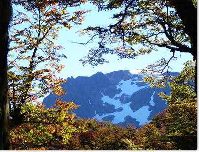
Once the mallín is left behind the climb is steep and turns to the right. In about thirty-five minutes you reach the ¨Mirador del Valle del río Raquel¨ (Raquel River Valley Viewpoint). From this height onwards the forest will only be of Lengas (Nothofagus Pumilio). After the viewpoint you will find to more steep but short climbs and the rest of the track is much more pleasant for the traveller. Fourty minutes away the Raquel Viewvalley you reach the Teno Stream edge. The Teno Stream is born in the Hielo Azul Glacier thaw where you can find the refugio, by its southern edge. On this point, you are three kilometres away from the Refugio, a fourty-five minutes walk. The track is mostly flat. Ten minutes before reaching the Refugio you can see on your right a sign indicating the turn aside to the Refugio Natación.
|
Footbridge of the Rio Azul, at the beginning of the passage towards the Refuge of Hielo Azul
Signals in the footpath, marked very well and with posters, impossible to lose itself.
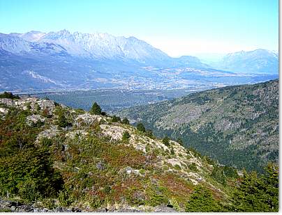
Viewpoint of El Raquel east view, is observed the valley of El Bolson and the Piltriquitron
View at 5 minutes to arrive for the first time at the Teno Stream
The footpath comes near to the Refuge of Hielo Azul
Refuge Hielo Azul (Blue Ice) |